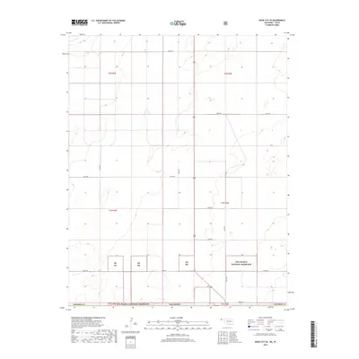
2018 Map of Boise City SE
USGS Topo · Published 2018About this map
The Rita Blanca National Grassland dominates the southern landscape of this section of Cimarron Co, Oklahoma. Located in the western panhandle, this region is characterized by a sparse grid of section roads and large tracts of public conservation land. The Beaver River cuts through the northwest corner, providing a rare water source in an otherwise arid plains environment. A network of rural routes including E0268 Rd and N0230 Rd serves the ranching and agricultural interests that define the local economy. The map illustrates the structured township and range system, specifically within t2n r4e and t2n r5e, where the interplay between private land and the dispersed units of the Rb Ng is clearly delineated.
Find a feature on this map
21 named features on this map. Tap any name to fly to it.
Don’t see what you’re looking for? This feature index may not catch every label — zoom into the map to look around manually.
Map Details
Editions of this 2018 Boise City SE Map
This is the sole edition of this map. No revisions or reprints were ever made.
Other maps of this area

1954 · Dalhart
USGS Topo · 1:250,000

1958 · Dalhart
USGS Topo · 1:250,000

1962 · Dalhart
USGS Topo · 1:250,000

1969 · Boise City
USGS Topo · 1:24,000

1969 · Boise City NW
USGS Topo · 1:24,000

1969 · Boise City SW
USGS Topo · 1:24,000

1969 · Boise City SE
USGS Topo · 1:24,000

1971 · Conrad NW
USGS Topo · 1:24,000

1971 · Conrad SW
USGS Topo · 1:24,000

1973 · Stratford 2 NW
USGS Topo · 1:24,000