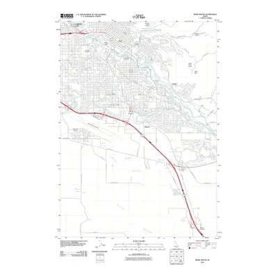
2010 Map of Boise South
USGS Topo · Published 2010About this map
The State Capitol stands at the heart of this Boise study, illustrating the city's complex relationship between urban development and the vital irrigation infrastructure of the Boise Valley. This 2010 survey details an intricate network of waterways, including the New York Canal, Settlers Canal, and Ridenbaugh Canal, which historically transformed the arid sagebrush plains into a fertile agricultural region. These canals thread through modern neighborhoods and institutional landmarks like Boise State University and the Boise Municipal Airport.
Find a feature on this map
67 named features on this map. Tap any name to fly to it.
Don’t see what you’re looking for? This feature index may not catch every label — zoom into the map to look around manually.
Map Details
Editions of this 2010 Boise South Map
This is the sole edition of this map. No revisions or reprints were ever made.
Other maps of this area

1892 · Boise
USGS Topo · 1:125,000

1892 · Bisuka
USGS Topo · 1:125,000

1894 · Bisuka
USGS Topo · 1:125,000

1897 · Boise
USGS Topo · 1:125,000

1949 · Robie Creek
USGS Topo · 1:24,000

1953 · Eagle
USGS Topo · 1:24,000

1953 · Cloverdale
USGS Topo · 1:24,000

1954 · Boise South
USGS Topo · 1:24,000

1954 · Boise North
USGS Topo · 1:24,000

1954 · Boise
USGS Topo · 1:62,500