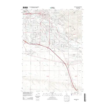
2013 Map of Boise South
USGS Topo · Published 2013About this map
The Boise River serves as the central artery for this portion of the Treasure Valley, supporting a complex network of irrigation and infrastructure. The map details the intricate path of the New York Canal, Ridenbaugh Canal, and Settlers Canal, which defined the region's agricultural development before urban expansion. Prominent landmarks such as Table Rock and the Boise Municipal Airport anchor the terrain, while the academic grounds of Boise State Univ sit just south of the river. For those researching local heritage, the map identifies several significant burial grounds, including the historic Pioneer Cem and Morris Hill Cem, alongside the Military Cem near the Ft Boise Military Res. The transition from the dense urban grid of Boise and Garden City into the southern canyons is marked by the path of the Boise Valley railroad and arterial roads like S Federal Way.
Find a feature on this map
53 named features on this map. Tap any name to fly to it.
Don’t see what you’re looking for? This feature index may not catch every label — zoom into the map to look around manually.
Map Details
Editions of this 2013 Boise South Map
This is the sole edition of this map. No revisions or reprints were ever made.
Other maps of this area

1892 · Boise
USGS Topo · 1:125,000

1892 · Bisuka
USGS Topo · 1:125,000

1894 · Bisuka
USGS Topo · 1:125,000

1897 · Boise
USGS Topo · 1:125,000

1949 · Robie Creek
USGS Topo · 1:24,000

1953 · Eagle
USGS Topo · 1:24,000

1953 · Cloverdale
USGS Topo · 1:24,000

1954 · Boise South
USGS Topo · 1:24,000

1954 · Boise North
USGS Topo · 1:24,000

1954 · Boise
USGS Topo · 1:62,500