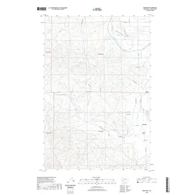
2020 Map of Boistfort
USGS Topo · Published 2020About this map
The South Fork Chehalis River winds through this section of Lewis County, defining a landscape of fertile valley bottoms and timbered uplands. This 2020 edition documents a rural region where long-standing agricultural settlements like Boistfort and Klaber remain central to the local identity. The topography is marked by the broad opening of Boistfort Prairie and the sheltered Lost Valley, both of which are fed by a complex drainage system including Stillman Creek and Halfway Cr. Near the northern boundary, the Willapa Hills State Park Trail follows a historic corridor past Ceres and Miller Swamp, offering a glimpse into the repurposing of former transportation routes. Local genealogy is anchored by the Boistfort Cem, while family-named roads like Moorecraft Rd and Roundtree Rd reveal the enduring legacy of early homesteaders in this river-valley community.
Find a feature on this map
54 named features on this map. Tap any name to fly to it.
Don’t see what you’re looking for? This feature index may not catch every label — zoom into the map to look around manually.
Map Details
Editions of this 2020 Boistfort Map
This is the sole edition of this map. No revisions or reprints were ever made.
Other maps of this area

1941 · Walville
USGS Topo · 1:62,500

1941 · Meskill
USGS Topo · 1:62,500

1941 · Skamokawa
USGS Topo · 1:62,500

1953 · Hoquiam
USGS Topo · 1:250,000

1953 · Ryderwood
USGS Topo · 1:62,500

1953 · Skamokawa
USGS Topo · 1:62,500

1953 · Pe Ell
USGS Topo · 1:62,500

1953 · Adna
USGS Topo · 1:62,500

1957 · Hoquiam
USGS Topo · 1:250,000

1958 · Hoquiam
USGS Topo · 1:250,000