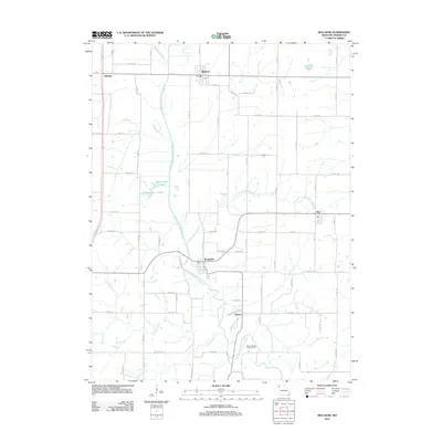
2012 Map of Bolckow
USGS Topo · Published 2012About this map
The One Hundred and Two River meanders south through this Andrew County landscape, serving as the central geographic feature for several rural settlements. In the early 21st century, the villages of Bolckow and Rosendale stand as the primary hubs, connected by a network of county roads like Rosendale Rd. Smaller communities such as Rea, Wyeth, and Midway are interspersed throughout the agricultural terrain, often situated near the river’s many tributaries, including Lower Neely Branch and White Cloud Creek.
Find a feature on this map
76 named features on this map. Tap any name to fly to it.
Don’t see what you’re looking for? This feature index may not catch every label — zoom into the map to look around manually.
Map Details
Editions of this 2012 Bolckow Map
This is the sole edition of this map. No revisions or reprints were ever made.
Other maps of this area

1923 · Clarksdale
USGS Topo · 1:62,500

1924 · St. Joseph
USGS Topo · 1:62,500

1925 · Clarksdale
USGS Topo · 1:62,500

1925 · Stanberry
USGS Topo · 1:62,500

1926 · Saint Joseph
USGS Topo · 1:62,500

1927 · Bolckow
USGS Topo · 1:62,500

1939 · Stanberry
USGS Topo · 1:62,500

1943 · Stanberry
USGS Topo · 1:62,500

1945 · Bolckow
USGS Topo · 1:62,500

1950 · Kansas City
USGS Topo · 1:250,000