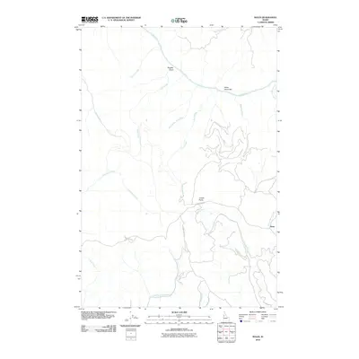
2010 Map of Boles
USGS Topo · Published 2010About this map
The Salmon River cuts through the northern reaches of this Idaho landscape, where the White House Bar and Ruggles Gulch mark the riverside terrain. Higher elevations are dominated by the Joseph Plains, a plateau dissected by a network of drainages including the evocatively named Home Sweet Home Creek and Mahoney Creek. The small settlement of Boles serves as a primary reference point in the east, situated near the confluence of Round Spring Creek and other mountain tributaries. Transportation in this area is defined by winding routes such as Flynn Creek Rd and Divide Creek Rd, which navigate the steep topography between the river canyon and the upland plains. This 2010 survey illustrates a sparsely populated region where the environment and drainage patterns remain the primary features of the land.
Find a feature on this map
20 named features on this map. Tap any name to fly to it.
Don’t see what you’re looking for? This feature index may not catch every label — zoom into the map to look around manually.
Map Details
Editions of this 2010 Boles Map
This is the sole edition of this map. No revisions or reprints were ever made.
Other maps of this area

1924 · Kamiah
USGS Topo · 1:125,000

1955 · Pullman
USGS Topo · 1:250,000

1955 · Grangeville
USGS Topo · 1:250,000

1958 · Pullman
USGS Topo · 1:250,000

1959 · Grangeville
USGS Topo · 1:250,000

1963 · Cactus Mtn
USGS Topo · 1:24,000

1963 · Boles
USGS Topo · 1:24,000

1963 · Rattlesnake Ridge
USGS Topo · 1:24,000

1963 · Moughmer Point
USGS Topo · 1:24,000

1963 · Joseph
USGS Topo · 1:24,000