
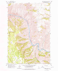
1963 Map of Moughmer Point
USGS Topo · Published 1965About this map
The Salmon River carves a deep path through the center of this Idaho landscape, creating a dramatic corridor flanked by Moughmer Ridge and Bingman Ridge. In the early 1960s, human activity along the river concentrated at points like American Bar and Cooper Bar, while the plateau of the Joseph Plains rises to the west. This survey illustrates the era's reliance on rudimentary transport networks, including a Tramway and several unnamed trails and jeep trails that negotiate the steep canyon walls. Distinctive topographical features like Devils Garden and the precipice of Moughmer Point highlight the land's difficult character. Small localized landmarks such as the Community Corral and Rice Creek Bridge indicate a sparse, ranching-oriented settlement pattern defined by the drainage systems of Rocky Canyon Creek and Gillespie Gulch.
Find a feature on this map
32 named features on this map. Tap any name to fly to it.
Don’t see what you’re looking for? This feature index may not catch every label — zoom into the map to look around manually.
Map Details
Editions of this 1963 Moughmer Point Map
2 editions found
Other maps of this area

1924 · Kamiah
USGS Topo · 1:125,000

1955 · Pullman
USGS Topo · 1:250,000

1955 · Grangeville
USGS Topo · 1:250,000

1958 · Pullman
USGS Topo · 1:250,000

1959 · Grangeville
USGS Topo · 1:250,000

1963 · Boles
USGS Topo · 1:24,000

1963 · Joseph
USGS Topo · 1:24,000

1963 · White Bird
USGS Topo · 1:24,000

1963 · Wolf Creek
USGS Topo · 1:24,000
1963 · Fenn
USGS Topo · 1:24,000