
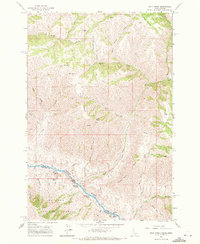
1963 Map of Wolf Creek
USGS Topo · Published 1965About this map
The Snake River carves a deep boundary between Idaho and Oregon in this mid-1960s survey, revealing a landscape defined by dramatic elevation changes and remote outposts. Along the river’s course, a series of turbulent stretches are documented, including Five Pine Rapids, Wolf Creek Rapids, and Copper Cr Rapids, reflecting the difficult navigation of the era. Small bars like Ragtown Bar and Roland Bar Rapids provide evidence of riverbank activity in this steep canyon environment.
Find a feature on this map
45 named features on this map. Tap any name to fly to it.
Don’t see what you’re looking for? This feature index may not catch every label — zoom into the map to look around manually.
Map Details
Editions of this 1963 Wolf Creek Map
2 editions found
Other maps of this area

1954 · Kernan Point
USGS Topo · 1:62,500

1955 · Grangeville
USGS Topo · 1:250,000

1959 · Grangeville
USGS Topo · 1:250,000

1963 · Cactus Mtn
USGS Topo · 1:24,000

1963 · Boles
USGS Topo · 1:24,000

1963 · Rattlesnake Ridge
USGS Topo · 1:24,000

1963 · Moughmer Point
USGS Topo · 1:24,000

1963 · Joseph
USGS Topo · 1:24,000

1963 · Grave Point
USGS Topo · 1:24,000

1980 · Grangeville
USGS Topo · 1:100,000