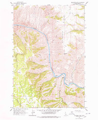
1963 Map of Moughmer Point
USGS Topo · Published 1977About this map
The Salmon River carves a deep, winding path through this portion of Idaho County, separating the high plateaus of the Joseph Plains from the steep, ridged terrain to the east. At the river's edge, small alluvial flats like American Bar and Cooper Bar indicate the few accessible points along the water where human activity concentrated. A network of trails and jeep trails navigates the elevation changes between Moughmer Ridge and the river banks, reflecting a landscape defined by ranching and transit.
Find a feature on this map
36 named features on this map. Tap any name to fly to it.
Don’t see what you’re looking for? This feature index may not catch every label — zoom into the map to look around manually.
Map Details
Editions of this 1963 Moughmer Point Map
2 editions found
Other maps of this area

1924 · Kamiah
USGS Topo · 1:125,000

1955 · Pullman
USGS Topo · 1:250,000

1955 · Grangeville
USGS Topo · 1:250,000

1958 · Pullman
USGS Topo · 1:250,000

1959 · Grangeville
USGS Topo · 1:250,000

1963 · Boles
USGS Topo · 1:24,000

1963 · Moughmer Point
USGS Topo · 1:24,000

1963 · Joseph
USGS Topo · 1:24,000

1963 · White Bird
USGS Topo · 1:24,000

1963 · Wolf Creek
USGS Topo · 1:24,000