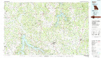
1984 Map of Bolivar
USGS Topo · Published 1984About this map
Stockton Lake and Pomme de Terre Lake dominate this mid-1980s landscape, illustrating the significant hydrological transformation of western Missouri. Controlled by the Stockton Dam, the waters of the Sac River and Little Sac River branch through the terrain, creating a complex shoreline that borders the Stockton State Park. Further east, the Pomme de Terre River feeds into its namesake reservoir, surrounded by numerous conservation areas like the Birdsong State Wildlife Area.
Find a feature on this map
83 named features on this map. Tap any name to fly to it.
Don’t see what you’re looking for? This feature index may not catch every label — zoom into the map to look around manually.
Map Details
Editions of this 1984 Bolivar Map
This is the sole edition of this map. No revisions or reprints were ever made.
Other maps of this area

1884 · Springfield
USGS Topo · 1:125,000

1884 · Bolivar
USGS Topo · 1:125,000

1886 · Nevada
USGS Topo · 1:125,000

1886 · Stockton
USGS Topo · 1:125,000

1886 · Greenfield
USGS Topo · 1:125,000

1886 · Carthage
USGS Topo · 1:125,000

1886 · Springfield
USGS Topo · 1:125,000

1887 · Clinton
USGS Topo · 1:125,000

1887 · Warsaw
USGS Topo · 1:125,000

1887 · Butler
USGS Topo · 1:125,000