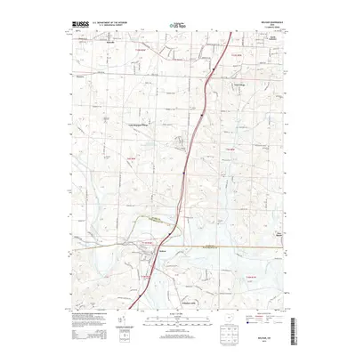
2013 Map of Bolivar
USGS Topo · Published 2013About this map
The Tuscarawas River valley defines the transition from Stark County into Tuscarawas County, serving as the central artery for the village of Bolivar. This 2013 survey reveals a landscape where modern residential clusters like Wilkshire Hills and Lake Sherman Village sit alongside deeply rooted local history. The map is particularly detailed for genealogists, marking numerous family and community burial grounds including Ft Laurens Cem, Zutavern Cem, and the Melsheimer Cem near Fohl Village. North of Bolivar Lake, the terrain is marked by a complex network of local roads such as Richville Dr SW and Fohl Rd SW, connecting smaller settlements like Richville and North Industry. The map captures the industrial and agricultural character of the region as Sandy Creek and Bear Run drain the rolling uplands toward the primary river channel.
Find a feature on this map
93 named features on this map. Tap any name to fly to it.
Don’t see what you’re looking for? This feature index may not catch every label — zoom into the map to look around manually.
Map Details
Editions of this 2013 Bolivar Map
This is the sole edition of this map. No revisions or reprints were ever made.
Other maps of this area

1901 · Massillon
USGS Topo · 1:62,500

1901 · Canton
USGS Topo · 1:62,500

1903 · Massillon
USGS Topo · 1:62,500

1903 · Canton
USGS Topo · 1:62,500

1912 · Dover
USGS Topo · 1:62,500

1914 · Navarre
USGS Topo · 1:62,500

1944 · Navarre
USGS Topo · 1:62,500

1944 · Dover
USGS Topo · 1:62,500

1951 · Canton
USGS Topo · 1:250,000

1951 · Bolivar
USGS Topo · 1:24,000