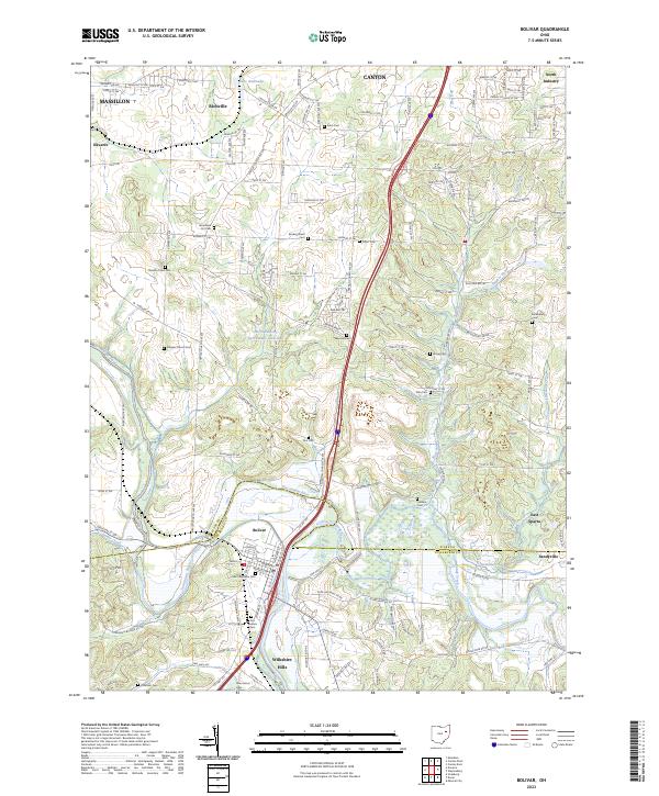
2023 Map of Bolivar
USGS Topo · Published 2023About this map
The Tuscarawas River carves a central path through this landscape, marking a historic boundary between the northern township of Richville and the southern village of Bolivar. This area on the Stark and Tuscarawas county line reveals a dense concentration of lineage-rich sites, including the Fort Laurens Cem and Saint Stephens Cem near the riverbanks. The topographical transition from the industrial outskirts of Massillon and Canton in the north to the more open terrain around East Sparta and Sandyville highlights the shifting land use of the region. Local water features like Beal Run and Sandy Creek support the drainage of this varied terrain, while numerous small cemeteries such as Zutavern Cem and Henline Cem are scattered across the rural townships.
Find a feature on this map
142 named features on this map. Tap any name to fly to it.
Don’t see what you’re looking for? This feature index may not catch every label — zoom into the map to look around manually.
Map Details
Editions of this 2023 Bolivar Map
This is the sole edition of this map. No revisions or reprints were ever made.
Other maps of this area

1901 · Massillon
USGS Topo · 1:62,500

1901 · Canton
USGS Topo · 1:62,500

1903 · Massillon
USGS Topo · 1:62,500

1903 · Canton
USGS Topo · 1:62,500

1912 · Dover
USGS Topo · 1:62,500

1914 · Navarre
USGS Topo · 1:62,500

1944 · Navarre
USGS Topo · 1:62,500

1944 · Dover
USGS Topo · 1:62,500

1951 · Canton
USGS Topo · 1:250,000

1951 · Bolivar
USGS Topo · 1:24,000