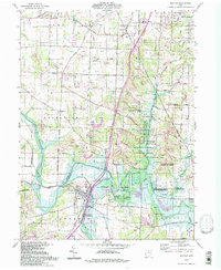
1994 Map of Bolivar
USGS Topo · Published 1998About this map
The Tuscarawas River carves a deep valley through this landscape, marking a historical divide where the Geographers Line and the Greenville Treaty Line converge near Bolivar. This 1990s-era record documents an area shaped by both frontier history and industrial extraction, featuring the Fort Laurens State Memorial and the Ohio Canal alongside numerous strip mines and a significant reclaimed area. The northern portion transition from the residential outskirts of Richville and North Industry to rural townships dotted with family-named landmarks like Shepler Ch and the Prairie College Sch. Extensive land management is visible through the Muskingum Watershed Conservancy District, reflecting a landscape dedicated to water control and resource preservation. Genealogists will find several burial grounds, including the Battlesburg Cem and Melchimer Cem, which serve as physical markers of the region's long-standing community roots.
Find a feature on this map
52 named features on this map. Tap any name to fly to it.
Don’t see what you’re looking for? This feature index may not catch every label — zoom into the map to look around manually.
Map Details
Editions of this 1994 Bolivar Map
This is the sole edition of this map. No revisions or reprints were ever made.
Other maps of this area

1901 · Massillon
USGS Topo · 1:62,500

1901 · Canton
USGS Topo · 1:62,500

1903 · Massillon
USGS Topo · 1:62,500

1903 · Canton
USGS Topo · 1:62,500

1912 · Dover
USGS Topo · 1:62,500

1914 · Navarre
USGS Topo · 1:62,500

1944 · Navarre
USGS Topo · 1:62,500

1944 · Dover
USGS Topo · 1:62,500

1951 · Canton
USGS Topo · 1:250,000

1951 · Bolivar
USGS Topo · 1:24,000