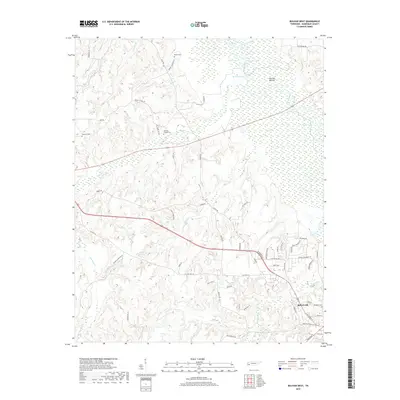
2019 Map of Bolivar West
USGS Topo · Published 2019About this map
Bolivar anchors the southeastern corner of this landscape, where the town grid transitions into the expansive wetlands of Hatchie Bottom. The Hatchie River meanders through the eastern portion of the map, creating a complex network of seasonal water bodies including Clover Lakes, Round Pond, and Turkey Pond. This riverine environment defines the local geography, with drainage from Potters Cr, Clear Cr, and Clover Creek feeding into the wider basin. The western uplands are marked by family-named landmarks and rural cemeteries such as Parker Cem, Bartlett Chapel Cem, and Norment Cem, which provide essential points of reference for genealogists and local historians. The road network, including Vildo Rd and Old Hwy 64, follows the contours of the terrain, avoiding the lowest reaches of the Hatchie River floodplain.
Find a feature on this map
63 named features on this map. Tap any name to fly to it.
Don’t see what you’re looking for? This feature index may not catch every label — zoom into the map to look around manually.
Map Details
Editions of this 2019 Bolivar West Map
This is the sole edition of this map. No revisions or reprints were ever made.
Other maps of this area

1950 · Hebron
USGS Topo · 1:24,000

1950 · Middleburg
USGS Topo · 1:24,000

1951 · Middleburg
USGS Topo · 1:24,000

1951 · Hebron
USGS Topo · 1:24,000

1951 · Hickory Valley
USGS Topo · 1:24,000

1956 · Blytheville
USGS Topo · 1:250,000

1959 · Blytheville
USGS Topo · 1:250,000

1959 · Whiteville
USGS Topo · 1:24,000

1959 · Hillville
USGS Topo · 1:24,000

1961 · Bolivar West
USGS Topo · 1:24,000