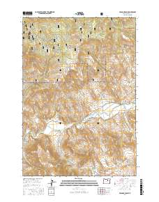
2017 Map of Bologna Basin
USGS Topo · Published 2017About this map
The North Fork John Day River carves through the landscape of Grant County, anchoring a region of deep canyons and seasonal water sources. Within the southern reaches of the Umatilla National Forest, the terrain is defined by dramatic elevation changes such as Thorn Spring Butte and Negro Knob. The settlement at Big Bend sits along the river's curve, marking a rare point of concentration in a landscape otherwise dominated by drainage systems like Rudio Cr and Birch Cr.
Find a feature on this map
37 named features on this map. Tap any name to fly to it.
Don’t see what you’re looking for? This feature index may not catch every label — zoom into the map to look around manually.
Map Details
Editions of this 2017 Bologna Basin Map
This is the sole edition of this map. No revisions or reprints were ever made.
Other maps of this area

1951 · Courtrock
USGS Topo · 1:62,500

1951 · Monument
USGS Topo · 1:62,500

1953 · Kimberly
USGS Topo · 1:62,500

1953 · Picture
USGS Topo · 1:62,500

1955 · Canyon City
USGS Topo · 1:250,000

1959 · Canyon City
USGS Topo · 1:250,000

1980 · Monument
USGS Topo · 1:100,000
1990 · Monument
USGS Topo · 1:24,000
1990 · Miller Flat
USGS Topo · 1:24,000
1990 · Bologna Basin
USGS Topo · 1:24,000