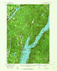
1958 Map of Bolton Landing
USGS Topo · Published 1964About this map
The shoreline of Lake George serves as the focal point for this mid-century survey of the eastern Adirondacks. From the established resorts at Bolton Landing and the Sagamore to the quiet lakeside hamlets of Hague and Silver Bay, the map documents a landscape defined by seasonal recreation and deep wilderness. The terrain is marked by steep peaks like Buck Mtn and Cat Mtn, where the Swede Mtn Lookout Tower once monitored the surrounding forests. Local navigation relied on prominent landmarks such as Sabbathday Point and Huletts Landing on the eastern shore in Dresden. Inland, the map reveals smaller upland settlements and clusters like Hogtown and Bartonville near the shores of Brant Lake, illustrating how the region's geography dictated the placement of small mountain communities and family-named landmarks during this post-war era of New York history.
Find a feature on this map
162 named features on this map. Tap any name to fly to it.
Don’t see what you’re looking for? This feature index may not catch every label — zoom into the map to look around manually.
Map Details
Editions of this 1958 Bolton Landing Map
4 editions found
Other maps of this area

1893 · Fort Ann
USGS Topo · 1:62,500

1893 · Whitehall
USGS Topo · 1:62,500

1894 · Ticonderoga
USGS Topo · 1:62,500

1895 · Whitehall
USGS Topo · 1:62,500

1895 · North Creek
USGS Topo · 1:62,500

1895 · Fort Ann
USGS Topo · 1:62,500

1895 · Paradox Lake
USGS Topo · 1:62,500

1895 · Glens Falls
USGS Topo · 1:62,500

1896 · Ticonderoga
USGS Topo · 1:62,500

1897 · Bolton
USGS Topo · 1:62,500