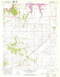
1959 Map of Bolton
USGS Topo · Published 1979About this map
Elk City Lake dominates the northern landscape of this Montgomery County survey, created by the impoundment of the Elk River. The map captures the transition from the river valley to the surrounding uplands, marked by distinctive heights like Bald Mound and Timber Hill. A significant industrial presence is defined by the extensive Oil Field operations scattered throughout the Rutland and Independence townships, indicating the importance of energy extraction to the local economy.
Find a feature on this map
27 named features on this map. Tap any name to fly to it.
Don’t see what you’re looking for? This feature index may not catch every label — zoom into the map to look around manually.
Map Details
Editions of this 1959 Bolton Map
3 editions found
Other maps of this area

1886 · Independence
USGS Topo · 1:125,000

1894 · Independence
USGS Topo · 1:125,000

1905 · Independence
USGS Topo · 1:125,000

1947 · Joplin
USGS Topo · 1:250,000

1949 · Joplin
USGS Topo · 1:250,000

1954 · Joplin
USGS Topo · 1:250,000

1958 · Joplin
USGS Topo · 1:250,000
1959 · Tyro
USGS Topo · 1:24,000

1959 · Joplin
USGS Topo · 1:250,000
1959 · Bolton
USGS Topo · 1:24,000