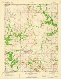
1959 Map of Tyro
USGS Topo · Published 1959About this map
The town of Tyro serves as the central hub of this late 1950s survey, where the Missouri Pacific railroad cuts through the southern landscape. An intricate network of rural infrastructure is visible, including the Old Indian Boundary line running east-west just south of the town center. This area is characterized by an active extractive economy, with extensive Oil Field developments and scattered Oil Wells punctuated by a Gravel Pit near Stony Point.
Find a feature on this map
29 named features on this map. Tap any name to fly to it.
Don’t see what you’re looking for? This feature index may not catch every label — zoom into the map to look around manually.
Map Details
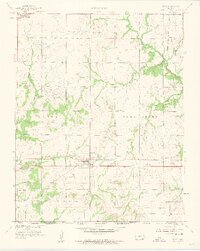
Editions of this 1959 Tyro Map
2 editions found
Other maps of this area

1886 · Independence
USGS Topo · 1:125,000

1894 · Independence
USGS Topo · 1:125,000

1901 · Nowata
USGS Topo · 1:125,000

1905 · Independence
USGS Topo · 1:125,000

1914 · Nowata
USGS Topo · 1:125,000

1947 · Joplin
USGS Topo · 1:250,000

1949 · Joplin
USGS Topo · 1:250,000

1954 · Tulsa
USGS Topo · 1:250,000

1954 · Joplin
USGS Topo · 1:250,000

1958 · Joplin
USGS Topo · 1:250,000