
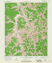
1953 Map of Boltsfork
USGS Topo · Published 1955About this map
Little Sandy River and its East Fork carve a deeply dissected landscape through the northern coalfields of Kentucky, where the local economy in the early 1950s was defined by a massive Gas Field and early Strip Mine operations. Small rural communities like Mavity and Alley serve as anchors for a network of valley settlements connected by winding roads. The topography is a dense web of ridges and gaps, notably Laurel Gap and Davis Gap, which dictated the placement of pioneer churches and schools. Local history is preserved in dozens of family-named burial grounds, such as Stevens Cem and Robinette Cem, which are scattered across the hillsides near the Boyd and Lawrence County line. The map illustrates a transitional period when energy extraction began to significantly reshape the traditional agricultural valleys of Boltsfork and Garner.
Find a feature on this map
74 named features on this map. Tap any name to fly to it.
Don’t see what you’re looking for? This feature index may not catch every label — zoom into the map to look around manually.
Map Details
Editions of this 1953 Boltsfork Map
2 editions found
Other maps of this area

1901 · Ceredo
USGS Topo · 1:62,500

1903 · Kenova
USGS Topo · 1:125,000

1904 · Kenova
USGS Topo · 1:125,000

1911 · Louisa
USGS Topo · 1:48,000

1913 · Ceredo
USGS Topo · 1:62,500

1913 · Louisa
USGS Topo · 1:62,500

1939 · Louisa
USGS Topo · 1:62,500
1953 · Prichard
USGS Topo · 1:24,000

1953 · Rush
USGS Topo · 1:24,000
1953 · Ashland
USGS Topo · 1:24,000