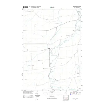
2013 Map of Bombay
USGS Topo · Published 2013About this map
The Little Salmon River meanders northward toward the Canadian border, defining the rural landscape of this northern Franklin County region. This 2013 survey details the primary settlement of Bombay, where a central Po and Hillside Rest Cem anchor the community at the junction of local routes. Further south, the hamlet of South Bombay sits along the riverbanks, while the northern edge of the map features the Fort Covington Port of Entry near the confluence with the Salmon River.
Find a feature on this map
60 named features on this map. Tap any name to fly to it.
Don’t see what you’re looking for? This feature index may not catch every label — zoom into the map to look around manually.
Map Details
Editions of this 2013 Bombay Map
This is the sole edition of this map. No revisions or reprints were ever made.
Other maps of this area

1915 · Malone
USGS Topo · 1:62,500

1915 · Moira
USGS Topo · 1:62,500

1917 · Malone
USGS Topo · 1:62,500

1917 · Moira
USGS Topo · 1:62,500

1944 · Moira
USGS Topo · 1:62,500

1948 · Ogdensburg
USGS Topo · 1:250,000

1951 · Ogdensburg
USGS Topo · 1:250,000

1953 · Ogdensburg
USGS Topo · 1:250,000

1961 · Ogdensburg
USGS Topo · 1:250,000
1964 · Ft. Covington
USGS Topo · 1:24,000