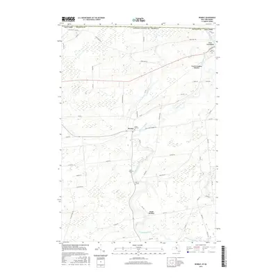
2016 Map of Bombay
USGS Topo · Published 2016About this map
Fort Covington and the village of Bombay anchor this northern Franklin County landscape near the United States border with Quebec. The terrain is defined by the winding course of the Little Salmon River, which dictates the placement of early road networks and small population centers like Fort Covington Hamlet and South Bombay. Many of the rural routes, such as Cook Farm Ln and Beaver Meadow Rd, trace older agricultural boundaries that have persisted for generations.
Find a feature on this map
60 named features on this map. Tap any name to fly to it.
Don’t see what you’re looking for? This feature index may not catch every label — zoom into the map to look around manually.
Map Details
Editions of this 2016 Bombay Map
This is the sole edition of this map. No revisions or reprints were ever made.
Other maps of this area

1915 · Malone
USGS Topo · 1:62,500

1915 · Moira
USGS Topo · 1:62,500

1917 · Malone
USGS Topo · 1:62,500

1917 · Moira
USGS Topo · 1:62,500

1944 · Moira
USGS Topo · 1:62,500

1948 · Ogdensburg
USGS Topo · 1:250,000

1951 · Ogdensburg
USGS Topo · 1:250,000

1953 · Ogdensburg
USGS Topo · 1:250,000

1961 · Ogdensburg
USGS Topo · 1:250,000
1964 · Ft. Covington
USGS Topo · 1:24,000