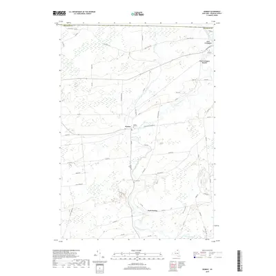
2019 Map of Bombay
USGS Topo · Published 2019About this map
The Little Salmon River meanders northward through Franklin County, anchoring a landscape defined by the historic community of Bombay and the nearby South Bombay. This 2019 survey illustrates the established rural character of the region, where the river system, including Pike Creek and the Salmon River, serves as a primary geographic feature. The map provides significant detail for genealogists, documenting several local burial grounds such as Saint Marys Cem near Fort Covington, Hillside Rest Cem, Saint Josephs Cem, and Sand Hill Cem.
Find a feature on this map
58 named features on this map. Tap any name to fly to it.
Don’t see what you’re looking for? This feature index may not catch every label — zoom into the map to look around manually.
Map Details
Editions of this 2019 Bombay Map
This is the sole edition of this map. No revisions or reprints were ever made.
Other maps of this area

1915 · Malone
USGS Topo · 1:62,500

1915 · Moira
USGS Topo · 1:62,500

1917 · Malone
USGS Topo · 1:62,500

1917 · Moira
USGS Topo · 1:62,500

1944 · Moira
USGS Topo · 1:62,500

1948 · Ogdensburg
USGS Topo · 1:250,000

1951 · Ogdensburg
USGS Topo · 1:250,000

1953 · Ogdensburg
USGS Topo · 1:250,000

1961 · Ogdensburg
USGS Topo · 1:250,000
1964 · Ft. Covington
USGS Topo · 1:24,000