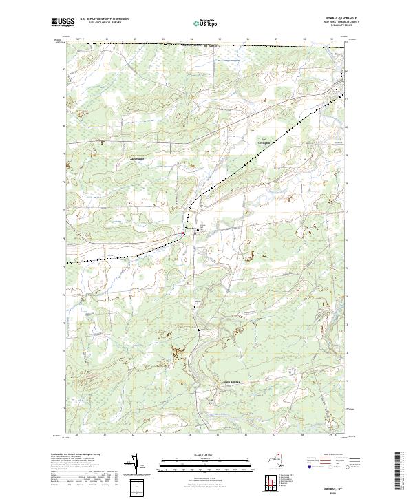
2023 Map of Bombay
USGS Topo · Published 2023About this map
The northern reaches of Franklin County meet the United States border in this 2023 survey of the landscape surrounding Akwesasne. The terrain is defined by the winding paths of the Salmon River and Little Salmon River, which flow northward toward the international boundary. The settlement of Bombay serves as a central hub for the surrounding rural area, connected by a network of secondary roads such as Foy-Eldred Rd and Coggin Bridge-Bombay Rd. For genealogists and local historians, the map identifies several significant burial sites, including Saint Marys Cem near Fort Covington and Saint Josephs Cem further south. These landmarks, along with family-named routes like Reardon Rd and Irish Ridge Rd, provide a modern record of the region's enduring community layout and its intricate wetlands and creek systems.
Find a feature on this map
56 named features on this map. Tap any name to fly to it.
Don’t see what you’re looking for? This feature index may not catch every label — zoom into the map to look around manually.
Map Details
Editions of this 2023 Bombay Map
This is the sole edition of this map. No revisions or reprints were ever made.
Other maps of this area

1915 · Malone
USGS Topo · 1:62,500

1915 · Moira
USGS Topo · 1:62,500

1917 · Malone
USGS Topo · 1:62,500

1917 · Moira
USGS Topo · 1:62,500

1944 · Moira
USGS Topo · 1:62,500

1948 · Ogdensburg
USGS Topo · 1:250,000

1951 · Ogdensburg
USGS Topo · 1:250,000

1953 · Ogdensburg
USGS Topo · 1:250,000

1961 · Ogdensburg
USGS Topo · 1:250,000
1964 · Ft. Covington
USGS Topo · 1:24,000