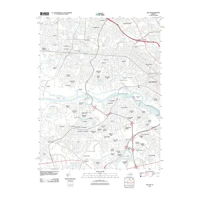
2010 Map of Bon Air
USGS Topo · Published 2010About this map
The James River and the historic James River and Kanawha Canal anchor this 2010 survey of the western suburbs of Richmond. The landscape reflects centuries of development, from the established grounds of the University of Richmond and its Westhampton Lake to the diverse residential enclaves of Tuckahoe, Westham, and Ziontown. The river itself is a focal point for infrastructure and industry, featuring the Bosher Dam, Williams Island Dam, and the Richmond Waterworks.
Find a feature on this map
136 named features on this map. Tap any name to fly to it.
Don’t see what you’re looking for? This feature index may not catch every label — zoom into the map to look around manually.
Map Details
Editions of this 2010 Bon Air Map
This is the sole edition of this map. No revisions or reprints were ever made.
Other maps of this area

1890 · Goochland
USGS Topo · 1:125,000

1892 · Goochland
USGS Topo · 1:125,000

1894 · Bermuda Hundred
USGS Topo · 1:62,500

1894 · Richmond
USGS Topo · 1:62,500

1895 · Richmond
USGS Topo · 1:62,500

1897 · Amelia
USGS Topo · 1:125,000

1934 · Richmond
USGS Topo · 1:24,000

1936 · Richmond West
USGS Topo · 1:24,000

1936 · Glen Allen
USGS Topo · 1:24,000

1938 · Drewrys Bluff
USGS Topo · 1:24,000