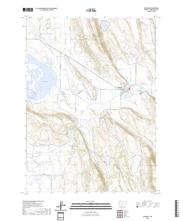
2023 Map of Bonanza
USGS Topo · Published 2023About this map
The town of Bonanza sits at the heart of this Klamath County landscape, positioned where the Lost River winds through a basin defined by agricultural history and complex water management. The intersection of Yonna Valley, Poe Valley, and Langell Valley creates a unique geographic hub, where irrigation features like the Yonna Ditch and Warden Reservoir illustrate the long-term engineering required to sustain local ranching and farming.
Find a feature on this map
42 named features on this map. Tap any name to fly to it.
Don’t see what you’re looking for? This feature index may not catch every label — zoom into the map to look around manually.
Map Details
Editions of this 2023 Bonanza Map
This is the sole edition of this map. No revisions or reprints were ever made.
Other maps of this area

1889 · Klamath
USGS Topo · 1:250,000

1894 · Klamath
USGS Topo · 1:250,000

1955 · Klamath Falls
USGS Topo · 1:250,000

1957 · Merrill
USGS Topo · 1:62,500

1957 · Swan Lake
USGS Topo · 1:62,500

1957 · Malin
USGS Topo · 1:62,500

1958 · Klamath Falls
USGS Topo · 1:250,000

1960 · Beatty
USGS Topo · 1:62,500
1985 · Dairy
USGS Topo · 1:24,000
1985 · Swan Lake
USGS Topo · 1:24,000