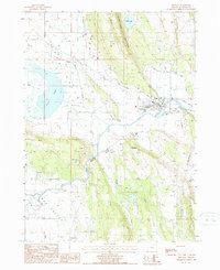
1988 Map of Bonanza
USGS Topo · Published 1988About this map
The town of Bonanza serves as the focal point of this late-twentieth-century landscape, situated where the Lost River winds through a high-desert basin. The geography is defined by broad flats like Yonna Valley and Langell Valley, separated by the steep rises of Short Lake Mountain and Bryant Mountain. Water management is central to the area's layout, evidenced by the presence of Harpold Dam, various pumping stations, and the seasonal character of Alkali Lake and Short Lake. The map details the rural infrastructure of the era, from a local Landing Strip and Radio Tower to the small community Cem and several gravel pits. These features suggest an economy closely tied to the land and the control of water resources in this part of Klamath County.
Find a feature on this map
21 named features on this map. Tap any name to fly to it.
Don’t see what you’re looking for? This feature index may not catch every label — zoom into the map to look around manually.
Map Details
Editions of this 1988 Bonanza Map
This is the sole edition of this map. No revisions or reprints were ever made.
Other maps of this area

1889 · Klamath
USGS Topo · 1:250,000

1894 · Klamath
USGS Topo · 1:250,000

1955 · Klamath Falls
USGS Topo · 1:250,000

1957 · Merrill
USGS Topo · 1:62,500

1957 · Swan Lake
USGS Topo · 1:62,500

1957 · Malin
USGS Topo · 1:62,500

1958 · Klamath Falls
USGS Topo · 1:250,000

1960 · Beatty
USGS Topo · 1:62,500
1985 · Dairy
USGS Topo · 1:24,000
1985 · Swan Lake
USGS Topo · 1:24,000