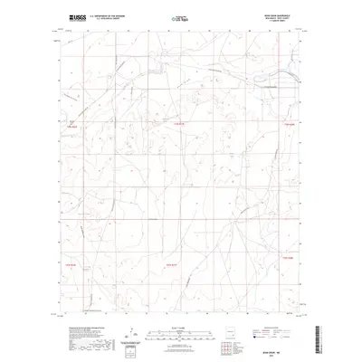
2023 Map of Bond Draw
USGS Topo · Published 2023About this map
Bond Draw carves through this corner of the Chihuahuan Desert, defining a landscape of arid drainages and hydraulic engineering south of the Black River. The arid terrain is marked by a network of seasonal watercourses, including Threemile Draw, China Draw, and the northern and southern branches of North Hackberry Draw. Human presence in this environment is centered on ranching and water management, evidenced by the numerous tanks scattered across the sections, such as Beaman Tank, Double Tank, and the uniquely named CCC Tank Number 2.
Find a feature on this map
24 named features on this map. Tap any name to fly to it.
Don’t see what you’re looking for? This feature index may not catch every label — zoom into the map to look around manually.
Map Details
Editions of this 2023 Bond Draw Map
This is the sole edition of this map. No revisions or reprints were ever made.
Other maps of this area

1939 · Carlsbad
USGS Topo · 1:62,500

1943 · Carlsbad
USGS Topo · 1:62,500

1943 · West Carlsbad
USGS Topo · 1:62,500

1945 · West Carlsbad
USGS Topo · 1:62,500

1945 · Carlsbad Caverns East
USGS Topo · 1:62,500

1945 · Malaga
USGS Topo · 1:62,500

1946 · Malaga
USGS Topo · 1:62,500

1947 · Carlsbad Caverns East
USGS Topo · 1:62,500

1954 · Carlsbad
USGS Topo · 1:250,000

1958 · Carlsbad
USGS Topo · 1:250,000