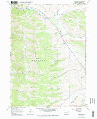
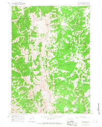
1967 Map of Bondurant
USGS Topo · Published 1971About this map
Bondurant sits at the heart of this high-country landscape, where the Hoback River cuts through the canyon country within the Teton National Forest. The settlement pattern in the late 1960s reflects a balance of forest management and isolated mountain homesteading, anchored by the Hoback Guard Sta and the Bondurant Cem. The terrain is defined by the massive spine of Monument Ridge, which rises over the valley and is capped by the Monument Ridge Lookout Tower, a critical post for fire surveillance during this era.
Find a feature on this map
28 named features on this map. Tap any name to fly to it.
Don’t see what you’re looking for? This feature index may not catch every label — zoom into the map to look around manually.
Map Details
Editions of this 1967 Bondurant Map
2 editions found
Other maps of this area

1907 · Gros Ventre
USGS Topo · 1:125,000

1910 · Gros Ventre
USGS Topo · 1:125,000

1931 · Jackson
USGS Topo · 1:125,000

1935 · Jackson
USGS Topo · 1:125,000

1955 · Driggs
USGS Topo · 1:250,000

1958 · Driggs
USGS Topo · 1:250,000

1962 · Driggs
USGS Topo · 1:250,000
1965 · Bull Creek
USGS Topo · 1:24,000
1965 · Hoback Peak
USGS Topo · 1:24,000
1965 · Clause Peak
USGS Topo · 1:24,000