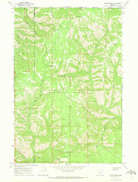
1967 Map of Bone Spring
USGS Topo · Published 1971About this map
Paradise Ridge and Broken Ridge define the high-elevation geography of this portion of the Umatilla National Forest in the late 1960s. The landscape is a network of ridges and deep drainages, where the Walla Walla River and South Fork Walla Walla River carve through the western slopes while the Wenaha Fork River drains to the southeast. Human presence is concentrated in a handful of high-country outposts like the Bone Spring Lookout Tower and the Reser Cabin, connected by the Skyline Road and historical transit corridors like the Paradise Pack Trail. This survey illustrates a wilderness management era characterized by seasonal campgrounds at Dequet Spring, Squaw Spring, and Bone Spring, which served as hubs for forest service activity and early backcountry recreation before more modern road developments.
Find a feature on this map
36 named features on this map. Tap any name to fly to it.
Don’t see what you’re looking for? This feature index may not catch every label — zoom into the map to look around manually.
Map Details
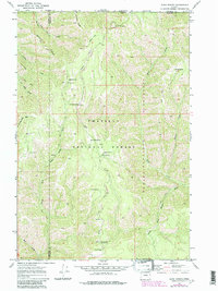
Editions of this 1967 Bone Spring Map
2 editions found
Other maps of this area

1919 · Walla Walla
USGS Topo · 1:125,000

1921 · Walla Walla
USGS Topo · 1:125,000

1937 · Pomeroy
USGS Topo · 1:96,000

1942 · Pomeroy
USGS Topo · 1:125,000

1953 · Pendleton
USGS Topo · 1:250,000

1953 · Walla Walla
USGS Topo · 1:250,000

1955 · Pullman
USGS Topo · 1:250,000

1955 · Grangeville
USGS Topo · 1:250,000

1956 · Pendleton
USGS Topo · 1:250,000

1958 · Pullman
USGS Topo · 1:250,000