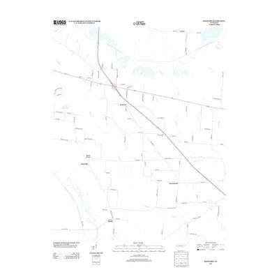
2013 Map of Bonicord
USGS Topo · Published 2013About this map
Bonicord and surrounding rural communities in West Tennessee are defined by the winding paths of the North Fork Forked Deer River and South Fork Forked Deer River. This landscape is primarily agricultural, with small settlements like Hawkinsville, Bruceville, and Beech Grove situated among a network of local roads such as Sorrell Chapel Rd and Mount Moriah Church Rd. The geography is intricately tied to its waterways, where Nash Cr, Pond Cr, and Cain Cr drain the low-lying lands, occasionally modified by drainage infrastructure like Parker Ditch. The distribution of family-named landmarks, including Clark Farm Lake, and small crossroad junctions like Cross Roads and Parker illustrate the enduring rural settlement patterns of the early 21st century. The map offers a detailed view of the local infrastructure, from the path of Nash Rd to the layout of Chestnut Bluff Rd, serving as a record of the region's contemporary land use and connectivity.
Find a feature on this map
82 named features on this map. Tap any name to fly to it.
Don’t see what you’re looking for? This feature index may not catch every label — zoom into the map to look around manually.
Map Details
Editions of this 2013 Bonicord Map
This is the sole edition of this map. No revisions or reprints were ever made.
Other maps of this area

1939 · Dyersburg
USGS Topo · 1:62,500

1939 · Halls
USGS Topo · 1:62,500

1952 · Gates
USGS Topo · 1:24,000

1952 · Bonicord
USGS Topo · 1:24,000

1952 · Newbern
USGS Topo · 1:24,000

1952 · Dyersburg
USGS Topo · 1:24,000

1952 · Chestnut Bluff
USGS Topo · 1:24,000

1952 · Fowlkes
USGS Topo · 1:24,000

1956 · Dyersburg
USGS Topo · 1:250,000

1956 · Blytheville
USGS Topo · 1:250,000