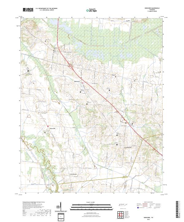
2022 Map of Bonicord
USGS Topo · Published 2022About this map
The confluence of Dyer, Lauderdale, and Crockett counties defines this corner of Tennessee, where the North Fork Forked Deer River and South Fork Forked Deer River create a complex system of bottomlands and drainage. The landscape is characterized by its numerous family and community burial grounds, such as Hodge Cem and Saint Peter Cem, which serve as vital markers for genealogists and local historians. Small rural centers like Bonicord and Hawkinsville are connected by a network of winding roads, including Old Hwy 20 and Sorrell Chapel Rd.
Find a feature on this map
90 named features on this map. Tap any name to fly to it.
Don’t see what you’re looking for? This feature index may not catch every label — zoom into the map to look around manually.
Map Details
Editions of this 2022 Bonicord Map
This is the sole edition of this map. No revisions or reprints were ever made.
Other maps of this area

1939 · Dyersburg
USGS Topo · 1:62,500

1939 · Halls
USGS Topo · 1:62,500

1952 · Gates
USGS Topo · 1:24,000

1952 · Bonicord
USGS Topo · 1:24,000

1952 · Newbern
USGS Topo · 1:24,000

1952 · Dyersburg
USGS Topo · 1:24,000

1952 · Chestnut Bluff
USGS Topo · 1:24,000

1952 · Fowlkes
USGS Topo · 1:24,000

1956 · Dyersburg
USGS Topo · 1:250,000

1956 · Blytheville
USGS Topo · 1:250,000