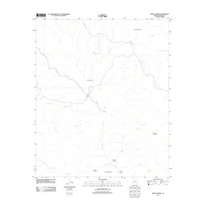
2011 Map of Bonita Spring
USGS Topo · Published 2011About this map
Bonita Creek snakes through this high desert terrain in Graham County, serving as the primary hydrological spine for a landscape defined by canyons and isolated water sources. The area is characterized by a network of seasonal drainages and springs essential for cattle ranching and survival, centered around the Bonita Camp site. Named peaks like Turkey Mountain and Turtle Mountain provide significant relief, while deeply cut features such as Midnight Canyon and Windy Canyon illustrate the complex erosion patterns of the region. The presence of numerous tanks and springs, including Dons Tank, Wild Deer Spring, and Hackberry Spring, highlights the critical importance of water management in this arid environment. Black River Rd offers the main passage through the northern portion of the quadrangle, connecting these remote landmarks.
Find a feature on this map
31 named features on this map. Tap any name to fly to it.
Don’t see what you’re looking for? This feature index may not catch every label — zoom into the map to look around manually.
Map Details
Editions of this 2011 Bonita Spring Map
This is the sole edition of this map. No revisions or reprints were ever made.
Other maps of this area

1902 · Clifton
USGS Topo · 1:62,500

1913 · Morenci
USGS Topo · 1:125,000

1915 · Morenci
USGS Topo · 1:125,000

1954 · Silver City
USGS Topo · 1:250,000

1954 · Clifton
USGS Topo · 1:250,000

1957 · Clifton
USGS Topo · 1:250,000

1958 · Silver City
USGS Topo · 1:250,000

1958 · Clifton
USGS Topo · 1:250,000

1960 · Guthrie
USGS Topo · 1:62,500

1960 · Safford
USGS Topo · 1:62,500