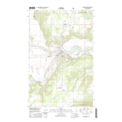
2017 Map of Bonners Ferry
USGS Topo · Published 2017About this map
The Kootenai River carves through this northern Idaho landscape, anchoring the city of Bonners Ferry and its surrounding agricultural benches. The river serves as a topographical divide, with the main settlement concentrated on the south bank while North Bench and Threemile Corner occupy the higher ground to the north. These upland areas are marked by a dense network of local roads such as Homestead Loop and Ponderosa Way, reflecting the region’s rural development.
Find a feature on this map
100 named features on this map. Tap any name to fly to it.
Don’t see what you’re looking for? This feature index may not catch every label — zoom into the map to look around manually.
Map Details
Editions of this 2017 Bonners Ferry Map
This is the sole edition of this map. No revisions or reprints were ever made.
Other maps of this area

1911 · Priest Lake
USGS Topo · 1:250,000

1913 · Priest Lake
USGS Topo · 1:250,000

1958 · Sandpoint
USGS Topo · 1:250,000

1963 · Sandpoint
USGS Topo · 1:250,000

1965 · Meadow Creek
USGS Topo · 1:24,000

1965 · Farnham Peak
USGS Topo · 1:24,000

1965 · Twentymile Creek
USGS Topo · 1:24,000

1965 · Moravia
USGS Topo · 1:24,000

1965 · Ritz
USGS Topo · 1:24,000
1965 · Moyie Springs
USGS Topo · 1:24,000