
1965 Map of Moravia
USGS Topo · Published 1967About this map
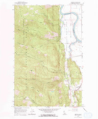
Kootenai River waters define the eastern lowlands of this 1960s Boundary County landscape, where the Kootenai National Wildlife Refuge meets the steep rising slopes of the Kaniksu National Forest. The settlement at Moravia serves as a focal point for local history, featuring a Grange Hall situated near the intersection of the Great Northern and Spokane International rail lines. This intersection highlights a period of significant regional transport activity, including the presence of the Deep Creek (Siding) and a Gaging Station further south. To the west, the terrain becomes increasingly complex, marked by distinct landmarks such as Snow Peak, Cascade Ridge, and Kootenai Point. Numerous waterways like Snow Creek and Caribou Creek drain these heights, which are traversed by a Pack Trail and a Jeep Trail, indicating the area's dual character of industrial rail transport and rugged backcountry recreation.
Find a feature on this map
33 named features on this map. Tap any name to fly to it.
Don’t see what you’re looking for? This feature index may not catch every label — zoom into the map to look around manually.
Map Details
Editions of this 1965 Moravia Map
2 editions found
Other maps of this area

1911 · Priest Lake
USGS Topo · 1:250,000

1913 · Priest Lake
USGS Topo · 1:250,000

1958 · Sandpoint
USGS Topo · 1:250,000

1963 · Sandpoint
USGS Topo · 1:250,000

1965 · Farnham Peak
USGS Topo · 1:24,000

1965 · Twentymile Creek
USGS Topo · 1:24,000

1965 · Ritz
USGS Topo · 1:24,000

1965 · Naples
USGS Topo · 1:24,000
1965 · Bonners Ferry
USGS Topo · 1:24,000
1967 · Roman Nose
USGS Topo · 1:24,000