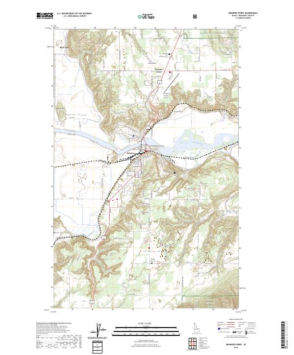
2024 Map of Bonners Ferry
USGS Topo · Published 2024About this map
Bonners Ferry serves as the focal point of this Boundary County landscape, situated where the Kootenai River winds through the prominent Purcell Trench. The town’s role as a regional seat is anchored by the Boundary County Courthouse, while its connection to wider trade is maintained by the Union Pacific RR line which skirts the western edge of the valley. To the south, the terrain opens into Paradise Valley, a notable pocket of activity marked by its own Paradise Valley Cem.
Find a feature on this map
119 named features on this map. Tap any name to fly to it.
Don’t see what you’re looking for? This feature index may not catch every label — zoom into the map to look around manually.
Map Details
Editions of this 2024 Bonners Ferry Map
This is the sole edition of this map. No revisions or reprints were ever made.
Other maps of this area

1911 · Priest Lake
USGS Topo · 1:250,000

1913 · Priest Lake
USGS Topo · 1:250,000

1958 · Sandpoint
USGS Topo · 1:250,000

1963 · Sandpoint
USGS Topo · 1:250,000

1965 · Meadow Creek
USGS Topo · 1:24,000

1965 · Farnham Peak
USGS Topo · 1:24,000

1965 · Twentymile Creek
USGS Topo · 1:24,000

1965 · Moravia
USGS Topo · 1:24,000

1965 · Ritz
USGS Topo · 1:24,000
1965 · Moyie Springs
USGS Topo · 1:24,000