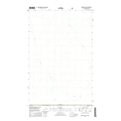
2017 Map of Bonnet Top OE N
USGS Topo · Published 2017About this map
The Yahk River winds through this northern borderland, where the wild terrain of the Kootenai National Forest meets the international boundary. This 2017 survey documents a high-elevation drainage system defined by a network of tributaries including Gilnockie Cr, Sprucetree Cr, and Boyd Cr. The map illustrates the stark geography at the intersection of Montana and British Columbia, providing a detailed view of the watercourses that feed into the larger river basin. While largely devoid of formal settlements, the map reveals the intricate natural hydrology of this remote corner of Lincoln Co, showing how the land was managed and partitioned along the United States and Canada border during the early 21st century.
Find a feature on this map
8 named features on this map. Tap any name to fly to it.
Don’t see what you’re looking for? This feature index may not catch every label — zoom into the map to look around manually.
Map Details
Editions of this 2017 Bonnet Top OE N Map
This is the sole edition of this map. No revisions or reprints were ever made.
Other maps of this area

1957 · Kalispell
USGS Topo · 1:250,000

1960 · Kalispell
USGS Topo · 1:250,000

1961 · Kalispell
USGS Topo · 1:250,000

1963 · Garver Mountain
USGS Topo · 1:24,000

1963 · Bonnet Top
USGS Topo · 1:24,000

1963 · Mount Henry
USGS Topo · 1:24,000

1979 · Yaak River
USGS Topo · 1:100,000
1997 · Mount Henry
USGS Topo · 1:24,000
1997 · Bonnet Top
USGS Topo · 1:24,000
1997 · Garver Mountain
USGS Topo · 1:24,000