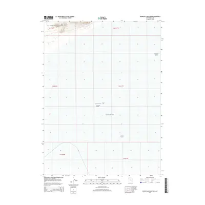
2014 Map of Bonneville Racetrack
USGS Topo · Published 2014About this map
The Bonneville Salt Flats dominate this landscape, providing the famously level surface that has hosted decades of land speed record attempts within the Great Salt Lake Desert. This 2014 survey captures the precise layout of the Bonneville Racetrack and the Hot Rod Track, world-renowned corridors of speed etched onto the crust of the prehistoric lakebed. To the northwest, the Silver Island Mountains rise abruptly from the flats at Silver Island, offering a sharp vertical contrast to the expansive white basin below. The map identifies specific operational segments of the facility, including the International Racetrack and its dedicated International Racetrack Overrun, marking the infrastructure required for the most extreme velocities reached in motorized sports.
Find a feature on this map
14 named features on this map. Tap any name to fly to it.
Don’t see what you’re looking for? This feature index may not catch every label — zoom into the map to look around manually.
Map Details
Editions of this 2014 Bonneville Racetrack Map
This is the sole edition of this map. No revisions or reprints were ever made.
Other maps of this area

1953 · Tooele
USGS Topo · 1:250,000

1955 · Tooele
USGS Topo · 1:250,000

1971 · Silver Island Pass
USGS Topo · 1:24,000

1971 · Graham Peak
USGS Topo · 1:24,000

1971 · Tetzlaff Peak
USGS Topo · 1:24,000

1971 · Bonneville Racetrack
USGS Topo · 1:24,000

1973 · Arinosa
USGS Topo · 1:24,000

1973 · Floating Island SW
USGS Topo · 1:24,000
1973 · Silsbee
USGS Topo · 1:24,000
1973 · Salduro
USGS Topo · 1:24,000