
1973 Map of Arinosa
USGS Topo · Published 1977About this map
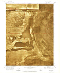
The Western Pacific railroad cuts a straight horizontal line across this high-desert landscape in the early 1970s, serving as the primary corridor through a region dominated by salt and sediment. Located along these tracks is Arinosa, a point of interest for those studying the rail history of the Great Salt Lake Desert. The northern edge of the Wendover Air Force Range occupies the lower portion of the map, illustrating the intersection of military training grounds and commercial transport routes in Tooele County. The terrain is characterized by extensive Mud Flat areas, where subtle variations in surface texture are the primary features in an otherwise sparse environment. This orthophotomap provides a clear view of the land's actual surface as it appeared during 1972 aerial surveys, documenting the isolation of these remote rail sidings and military boundaries before modern developments.
Find a feature on this map
4 named features on this map. Tap any name to fly to it.
Don’t see what you’re looking for? This feature index may not catch every label — zoom into the map to look around manually.
Map Details
Editions of this 1973 Arinosa Map
This is the sole edition of this map. No revisions or reprints were ever made.
Other maps of this area

1953 · Tooele
USGS Topo · 1:250,000

1955 · Tooele
USGS Topo · 1:250,000

1971 · Bonneville Racetrack
USGS Topo · 1:24,000

1973 · Arinosa SE
USGS Topo · 1:24,000

1973 · Floating Island SW
USGS Topo · 1:24,000

1973 · Arinosa SW
USGS Topo · 1:24,000

1973 · Arinosa NE
USGS Topo · 1:24,000

1973 · Salduro SE
USGS Topo · 1:24,000

1973 · Floating Island SE
USGS Topo · 1:24,000
1973 · Salduro
USGS Topo · 1:24,000