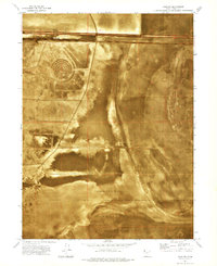
1973 Map of Salduro
USGS Topo · Published 1977About this map
The Bonneville Salt Flats dominate this 1970s orthophotomap, revealing the stark, geometric patterns of this famous Utah landscape. At the heart of the salt crust lies Salduro, a small outpost alongside the Western Pacific railroad and a nearby Pumping Station. The map captures the infrastructure supporting transit across the basin, including a series of Siphons, a Radio Facility, and an Observation Tower.
Find a feature on this map
14 named features on this map. Tap any name to fly to it.
Don’t see what you’re looking for? This feature index may not catch every label — zoom into the map to look around manually.
Map Details
Editions of this 1973 Salduro Map
This is the sole edition of this map. No revisions or reprints were ever made.
Other maps of this area

1953 · Tooele
USGS Topo · 1:250,000

1955 · Tooele
USGS Topo · 1:250,000

1971 · Tetzlaff Peak
USGS Topo · 1:24,000

1971 · Bonneville Racetrack
USGS Topo · 1:24,000

1973 · Arinosa
USGS Topo · 1:24,000

1973 · Floating Island SW
USGS Topo · 1:24,000

1973 · Arinosa SW
USGS Topo · 1:24,000
1973 · Salduro SW
USGS Topo · 1:24,000

1973 · Salduro SE
USGS Topo · 1:24,000
1973 · Silsbee
USGS Topo · 1:24,000