
1973 Map of Salduro SE
USGS Topo · Published 1977About this map
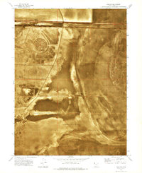
The harsh, salt-crusted expanse of the Great Salt Lake Desert dominates this 1973 orthophotomap of the Tooele County region. The terrain is primarily defined as Alkali Or Mud, a flat and unforgiving environment where seasonal moisture and mineral deposits create a shifting, low-relief surface. This specific area falls within the massive Wendover Air Force Range, a Cold War-era military testing ground that utilized these remote basins for various maneuvers and ballistics testing. Evidence of human passage is sparse, limited to a lonely Jeep Trail that cuts through the southwestern corner, likely used for range maintenance or mineral exploration. The map's photographic base clearly shows the marbled patterns of the salt flats, offering a rare visual record of the desert floor before subsequent environmental shifts and military activity altered the surface textures.
Find a feature on this map
6 named features on this map. Tap any name to fly to it.
Don’t see what you’re looking for? This feature index may not catch every label — zoom into the map to look around manually.
Map Details
Editions of this 1973 Salduro SE Map
This is the sole edition of this map. No revisions or reprints were ever made.
Other maps of this area

1953 · Tooele
USGS Topo · 1:250,000

1955 · Tooele
USGS Topo · 1:250,000
1972 · Elephant Knoll NW
USGS Topo · 1:24,000
1972 · Elephant Knoll NE
USGS Topo · 1:24,000

1973 · Arinosa
USGS Topo · 1:24,000

1973 · Arinosa SW
USGS Topo · 1:24,000
1973 · Salduro SW
USGS Topo · 1:24,000
1973 · Silsbee
USGS Topo · 1:24,000
1973 · Salduro
USGS Topo · 1:24,000
1973 · South of Arinosa SW
USGS Topo · 1:24,000