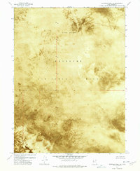
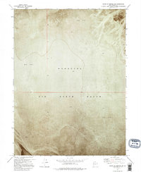
1972 Map of Elephant Knoll NE
USGS Topo · Published 1977About this map
Alkali or Mud terrain dominates this 1972 orthophotomap, showing the stark, desolate character of the Utah salt flats within the Wendover Air Force Range. Produced from aerial photography, the map reveals a landscape defined by expansive salt crusts and seasonal mud, largely devoid of roads or settlements. Several survey markers, including BM 4226 and BM 4228, provide the only fixed points of reference across the uniform surface. This specialized imagery highlights the intersection of military training space and the unique geological formations of the Tooele County desert during the early 1970s.
Find a feature on this map
9 named features on this map. Tap any name to fly to it.
Don’t see what you’re looking for? This feature index may not catch every label — zoom into the map to look around manually.
Map Details
Editions of this 1972 Elephant Knoll NE Map
2 editions found
Other maps of this area

1953 · Tooele
USGS Topo · 1:250,000

1955 · Tooele
USGS Topo · 1:250,000

1972 · Elephant Knoll
USGS Topo · 1:24,000
1972 · Elephant Knoll NW
USGS Topo · 1:24,000

1972 · Elephant Knoll SE
USGS Topo · 1:24,000

1973 · Arinosa SW
USGS Topo · 1:24,000
1973 · Salduro SW
USGS Topo · 1:24,000

1973 · Salduro SE
USGS Topo · 1:24,000

1973 · Gold Hill 1 SW
USGS Topo · 1:24,000
1973 · South of Arinosa SW
USGS Topo · 1:24,000