
1973 Map of Gold Hill 1 SW
USGS Topo · Published 1977About this map
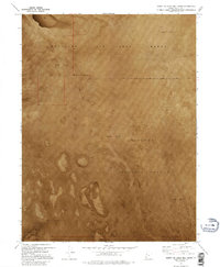
Mud Flat dominates this 1973 orthophotomosaic, revealing the stark and specialized landscape of Tooele County during the Cold War. The sheet is defined by its military boundaries, split between the Wendover Air Force Range to the north and the Dugway Proving Ground to the south. This terrain, mapped via photogrammetric methods, shows the expansive, featureless basins used for testing and training. The absence of traditional settlements or infrastructure highlights the extreme isolation of these desert tracts, where land management was dictated entirely by the Department of Defense. Researchers of military history can trace the precise demarcations of these restricted zones across the arid interior of the Great Salt Lake Desert.
Find a feature on this map
7 named features on this map. Tap any name to fly to it.
Don’t see what you’re looking for? This feature index may not catch every label — zoom into the map to look around manually.
Map Details
Editions of this 1973 Gold Hill 1 SW Map
2 editions found
Other maps of this area

1925 · Gold Hill
USGS Topo · 1:62,500

1928 · Gold Hill
USGS Topo · 1:62,500

1953 · Tooele
USGS Topo · 1:250,000

1955 · Tooele
USGS Topo · 1:250,000
1972 · Elephant Knoll NE
USGS Topo · 1:24,000

1972 · Elephant Knoll SE
USGS Topo · 1:24,000
1973 · Gold Hill
USGS Topo · 1:24,000

1973 · Gold Hill 1 SE
USGS Topo · 1:24,000

1973 · Gold Hill 1 NE
USGS Topo · 1:24,000
1973 · Gold Hill 4 NE
USGS Topo · 1:24,000