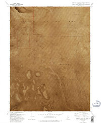
1973 Map of North of Gold Hill Wash
USGS Topo · Published 1995About this map
Dugway Proving Ground and the Wendover Air Force Range dominate this expansive 1973 orthophotomap of the Utah desert. The landscape is characterized by a nearly featureless expanse of Mud Flat, where the lack of human settlements or road networks highlights the area's isolation and its historical role as a restricted military testing and training zone. This orthophotomosaic, compiled from aerial photography, provides a literal visual record of the arid floor of the Great Salt Lake Desert within Tooele County. The absence of traditional topographic contours in favor of photographic detail allows for a precise examination of the natural drainage patterns and subtle changes in the alkaline surface that are often lost on conventional maps.
Find a feature on this map
3 named features on this map. Tap any name to fly to it.
Don’t see what you’re looking for? This feature index may not catch every label — zoom into the map to look around manually.
Map Details
Editions of this 1973 North of Gold Hill Wash Map
2 editions found
Other maps of this area

1925 · Gold Hill
USGS Topo · 1:62,500

1928 · Gold Hill
USGS Topo · 1:62,500

1953 · Tooele
USGS Topo · 1:250,000

1955 · Tooele
USGS Topo · 1:250,000
1972 · Elephant Knoll NE
USGS Topo · 1:24,000

1972 · Elephant Knoll SE
USGS Topo · 1:24,000
1973 · Gold Hill
USGS Topo · 1:24,000

1973 · Gold Hill 1 SE
USGS Topo · 1:24,000

1973 · Gold Hill 1 SW
USGS Topo · 1:24,000

1973 · Gold Hill 1 NE
USGS Topo · 1:24,000