
1973 Map of Gold Hill 1 NE
USGS Topo · Published 1977About this map
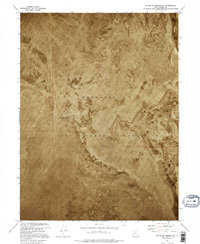
Wendover Air Force Range dominates the eastern Great Salt Lake Desert on this 1973 orthophotomap, showing a landscape defined by military utility and geological extremes. The territory is characterized by expansive Mud Flat terrain, where the fine-grained alkaline soils create a stark, level surface that historically served as a critical testing ground for the United States military. The orthophotomap format, which layers topographic contour lines over aerial photography, reveals the subtle variations in the desert floor and the isolation of the range. Located in western Tooele County, the area illustrates the mid-century reliance on the remote basins of Utah for expansive military operations where the flat geography and lack of permanent settlement were primary strategic assets.
Find a feature on this map
4 named features on this map. Tap any name to fly to it.
Don’t see what you’re looking for? This feature index may not catch every label — zoom into the map to look around manually.
Map Details
Editions of this 1973 Gold Hill 1 NE Map
2 editions found
Other maps of this area

1953 · Tooele
USGS Topo · 1:250,000

1955 · Tooele
USGS Topo · 1:250,000

1973 · Knolls SW
USGS Topo · 1:24,000

1973 · Arinosa SE
USGS Topo · 1:24,000

1973 · Arinosa SW
USGS Topo · 1:24,000

1973 · Wildcat Mountain SW
USGS Topo · 1:24,000

1973 · Wildcat Mountain NW
USGS Topo · 1:24,000

1973 · Gold Hill 1 SE
USGS Topo · 1:24,000

1973 · Gold Hill 1 SW
USGS Topo · 1:24,000
1973 · South of Arinosa SW
USGS Topo · 1:24,000