
1973 Map of Wildcat Mountain SW
USGS Topo · Published 1977About this map
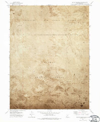
Dugway Proving Ground and the Wendover Air Force Range dominate this 1973 orthophotomap, revealing the austere landscape of the Great Salt Lake Desert. This specialized survey utilizes an orthophotomosaic to provide a photographic record of the terrain, where the expansive Mud Flat stretches across the quadrangle. The lack of traditional civil infrastructure like schools or towns reflects the area's strict military utility during the mid-20th century. Researchers can observe the subtle variations in surface texture and drainage patterns across the desert floor, bounded by the township and range lines of the Range 14 and 15 West and Township 6 and 7 South.
Find a feature on this map
6 named features on this map. Tap any name to fly to it.
Don’t see what you’re looking for? This feature index may not catch every label — zoom into the map to look around manually.
Map Details
Editions of this 1973 Wildcat Mountain SW Map
2 editions found
Other maps of this area

1953 · Tooele
USGS Topo · 1:250,000

1954 · Wildcat Mtn
USGS Topo · 1:24,000

1954 · Granite Peak
USGS Topo · 1:24,000

1954 · Wildcat Mtn SE
USGS Topo · 1:24,000

1955 · Tooele
USGS Topo · 1:250,000

1973 · Wildcat Mountain NW
USGS Topo · 1:24,000

1973 · Gold Hill 1 SE
USGS Topo · 1:24,000

1973 · Gold Hill 1 NE
USGS Topo · 1:24,000

1973 · Granite Peak NW
USGS Topo · 1:24,000
1973 · Gold Hill 4 NE
USGS Topo · 1:24,000