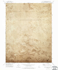
1973 Map of Wildcat Mountain SW
USGS Topo · Published 1987About this map
Dugway Proving Ground and the Wendover Air Force Range dominate this 1973 orthophotomap, illustrating the expansive military footprint in the Great Salt Lake Desert. Unlike traditional line-drawn topographic maps, this edition uses an orthophotomosaic to show the actual texture of the vast Mud Flat that defines the Tooele County landscape. The photographic base reveals the subtle, shifting surface patterns and drainage features of the basin floor that a standard map might simplify. This specialized survey by the Geological Survey and NOS/NOAA focuses on a critical restricted area, documenting the stark boundary between the northern air force range and the southern proving ground as they appeared in the early 1970s.
Find a feature on this map
6 named features on this map. Tap any name to fly to it.
Don’t see what you’re looking for? This feature index may not catch every label — zoom into the map to look around manually.
Map Details
Editions of this 1973 Wildcat Mountain SW Map
2 editions found
Other maps of this area

1953 · Tooele
USGS Topo · 1:250,000

1954 · Wildcat Mtn
USGS Topo · 1:24,000

1954 · Granite Peak
USGS Topo · 1:24,000

1954 · Wildcat Mtn SE
USGS Topo · 1:24,000

1955 · Tooele
USGS Topo · 1:250,000

1973 · Wildcat Mountain SW
USGS Topo · 1:24,000

1973 · Wildcat Mountain NW
USGS Topo · 1:24,000

1973 · Gold Hill 1 SE
USGS Topo · 1:24,000

1973 · Gold Hill 1 NE
USGS Topo · 1:24,000

1973 · Granite Peak NW
USGS Topo · 1:24,000