
1973 Map of Gold Hill 1 SE
USGS Topo · Published 1977About this map
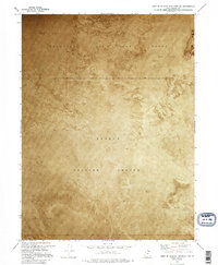
Dugway Proving Ground dominates the southeastern quadrant of this orthophotomap, representing a critical era of mid-century military expansion in the Great Salt Lake Desert. The landscape is characterized by expansive stretches of Mud Flat, where the lack of vegetation and relief provided an ideal environment for large-scale testing and training operations. To the northwest, the boundary of the Wendover Air Force Range marks a significant intersection of defense-related land use. This 1973 survey utilizes an orthophotomosaic to document the stark, unpopulated terrain, revealing the subtle variations in surface texture and drainage patterns that define this stretch of Tooele County. The sparse network of unimproved roads and survey lines provides the only evidence of human intervention in this isolated desert reach.
Find a feature on this map
6 named features on this map. Tap any name to fly to it.
Don’t see what you’re looking for? This feature index may not catch every label — zoom into the map to look around manually.
Map Details
Editions of this 1973 Gold Hill 1 SE Map
2 editions found
Other maps of this area

1953 · Tooele
USGS Topo · 1:250,000

1955 · Tooele
USGS Topo · 1:250,000

1973 · Wildcat Mountain SW
USGS Topo · 1:24,000

1973 · Wildcat Mountain NW
USGS Topo · 1:24,000

1973 · Gold Hill 1 SW
USGS Topo · 1:24,000

1973 · Gold Hill 1 NE
USGS Topo · 1:24,000

1973 · Granite Peak NW
USGS Topo · 1:24,000
1973 · Gold Hill 4 NE
USGS Topo · 1:24,000
1973 · Gold Hill Wash
USGS Topo · 1:24,000
1973 · South of Arinosa SW
USGS Topo · 1:24,000