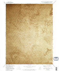
1973 Map of West of Wildcat Mountain SW
USGS Topo · Published 1995About this map
Dugway Proving Ground and the Wendover Air Force Range dominate this 1973 orthophotomosaic, providing a stark visual record of the high desert military landscape in Tooele County. Unlike traditional line-drawn maps, this survey uses aerial photography to capture the literal texture of the Mud Flat terrain, revealing the subtle variations in surface reflectance and drainage patterns across the arid basin. The boundary between Range 16 West and Range 15 West bisects the image, marking the geometric precision of the Public Land Survey System against the seemingly chaotic natural alkaline flats. This document captures the region during a period of intense military utility, where the remote landscape was utilized for large-scale testing and training operations far from Utah's population centers.
Find a feature on this map
6 named features on this map. Tap any name to fly to it.
Don’t see what you’re looking for? This feature index may not catch every label — zoom into the map to look around manually.
Map Details
Editions of this 1973 West of Wildcat Mountain SW Map
2 editions found
Other maps of this area

1953 · Tooele
USGS Topo · 1:250,000

1955 · Tooele
USGS Topo · 1:250,000

1973 · Wildcat Mountain SW
USGS Topo · 1:24,000

1973 · Wildcat Mountain NW
USGS Topo · 1:24,000

1973 · Gold Hill 1 SE
USGS Topo · 1:24,000

1973 · Gold Hill 1 SW
USGS Topo · 1:24,000

1973 · Gold Hill 1 NE
USGS Topo · 1:24,000

1973 · Granite Peak NW
USGS Topo · 1:24,000
1973 · Gold Hill 4 NE
USGS Topo · 1:24,000
1973 · Gold Hill Wash
USGS Topo · 1:24,000