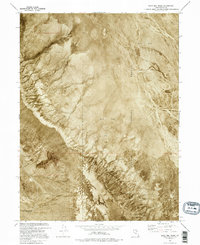
1973 Map of Gold Hill Wash
USGS Topo · Published 1995About this map
Dugway Proving Ground occupies the eastern expanse of this orthophotomap, where the desolate landscape of the Great Salt Lake Desert meets military boundary lines. The visual data, derived from 1973 aerial photography, reveals the intricate drainage patterns of Gold Hill Wash and Rodenhouse Wash as they cut through the arid terrain. Unlike standard topographic sheets, this orthophoto provides a direct photographic record of the Mud Flat environments that dominate the area's geology. This 1973 field-checked survey captures the stark transition between the alluvial fans of the western mountains and the vast, level surfaces used for military testing. The map is a valuable resource for understanding the mid-century physical state of these remote Tooele County lands before modern developments or changes in land use shifted the desert floor's character.
Find a feature on this map
4 named features on this map. Tap any name to fly to it.
Don’t see what you’re looking for? This feature index may not catch every label — zoom into the map to look around manually.
Map Details
Editions of this 1973 Gold Hill Wash Map
This is the sole edition of this map. No revisions or reprints were ever made.
Other maps of this area

1925 · Gold Hill
USGS Topo · 1:62,500

1928 · Gold Hill
USGS Topo · 1:62,500

1953 · Tooele
USGS Topo · 1:250,000

1955 · Tooele
USGS Topo · 1:250,000

1972 · Elephant Knoll SE
USGS Topo · 1:24,000
1973 · Gold Hill 4 SE
USGS Topo · 1:24,000
1973 · Gold Hill
USGS Topo · 1:24,000

1973 · Gold Hill 1 SE
USGS Topo · 1:24,000

1973 · Gold Hill 1 SW
USGS Topo · 1:24,000
1973 · Gold Hill 4 NE
USGS Topo · 1:24,000