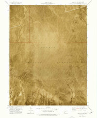
1973 Map of Gold Hill 4 SE
USGS Topo · Published 1977About this map
Dugway Proving Ground dominates this 1973 orthophotomap, showcasing a stark, utilitarian landscape within Tooele County. Unlike traditional topographic maps, this orthophotomosaic utilizes aerial photography taken in 1973 to provide a direct visual record of the arid terrain. The map is defined by expansive stretches of Mud Flat, where the lack of vegetation and the flat, alkaline soil create a distinct texture visible in the photographic base. This specific quadrant, managed by the Dugway Proving Ground, reflects the mid-century military footprint in the Utah desert, prioritizing wide-open spaces for testing and operations. The minimal labeling highlights the geographic isolation of the region, focusing almost entirely on the vast natural basins and the military boundary that defines its modern use.
Find a feature on this map
2 named features on this map. Tap any name to fly to it.
Don’t see what you’re looking for? This feature index may not catch every label — zoom into the map to look around manually.
Map Details
Editions of this 1973 Gold Hill 4 SE Map
2 editions found
Other maps of this area

1908 · Fish Springs
USGS Topo · 1:250,000

1910 · Fish Springs
USGS Topo · 1:250,000

1953 · Tooele
USGS Topo · 1:250,000

1953 · Delta
USGS Topo · 1:250,000

1955 · Tooele
USGS Topo · 1:250,000

1958 · Delta
USGS Topo · 1:250,000

1962 · Delta
USGS Topo · 1:250,000

1967 · Fish Springs NW
USGS Topo · 1:24,000

1973 · Granite Peak NW
USGS Topo · 1:24,000
1973 · Granite Peak SW
USGS Topo · 1:24,000